Azumayama ―Preparing for volcanic disaster―
Azumayama Summary
Topography and Geology

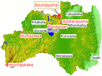
Azumayama Location Map
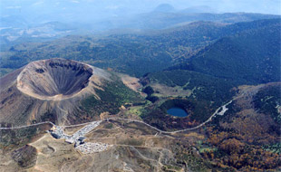
Azumayama is a family of active volcanoes stretching from the highest peak of Nishi Azumayama at the border of Yamagata・Fukushima prefectures (2035 m) to Higashi Azumayama, Issaikyozan and Azumakofuji. About 22 km long from east to west and 15 km long from north to south, this volcano is roughly divided into two chains (east-southeast and west-northwest). The northern chain seems to be more recent than the southern one. Incidentally the eastern part of both individual chains seems to be more recent than the western part. Many volcanic craters and cones can be observed at the northern chain, particularly the more recent ones at Goshikinuma, Oana, Okenuma and Azumakofuji at the eastern side. The only recorded location of volcanic eruptions so far is the Issaikyozan (1949m) at the northern chain, the biggest observed in 1893. Currently fumarolic activity has been noted along its southeastern slope.

Emergency mitigation measures
Azumayama volcano eruption emergency mitigation measures and erosion control plan
Azumayama volcano eruption emergency mitigation measures and erosion control plan was devised by Regional Development Bureaus and Prefectural Erosion Control Departments to minimize the potential damage of lava, lahar and debris flows after volcanic eruption utilizing both hard and soft measures.
Since volcanic activity has a potential to severely affecting the society, this plan was applied to all 29 active volcanoes which had hazard maps in 2007. Azumayama, Adatarayama and Bandaisan were the main targets in Fukushima Prefecture.
“Fukushima volcanic eruption emergency mitigation measures and erosion control plan review committee” is responsible for the three volcanoes in Fukushima (Azumayama, Adatarayama, Bandaisan) as of 2010.
Particularly in regard to Azumayama, committee established “Azumayama Working Group” which inspected the field four times before developing the “Azumayama volcano eruption emergency mitigation measures and erosion control plan” in January, 2013.
- Azumayama volcano eruption emergency mitigation measures and erosion control plan (Jan, 2013)[PDF:13MB]
- Azumayama volcano eruption emergency mitigation measures and erosion control plan summary[PDF:696KB]
- Azumayama volcanic eruption forecast area diagram compilation (extract version)[PDF:5.3MB]
※For forecast of other disaster areas please contact Fukushima River and National Highway Office. - F.A.Q.
- Press Briefing[PDF:1.1MB]
- Volcano eruption emergency mitigation measure and erosion control planning guidelines [Ministry of Land, Infrastructure, Transport and Tourism Homepage]

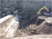
Example of hard emergency measures
Emergency stone removal for erosion control dam when
Kirishimayama (Shinmoedake) erupted in 2011.

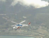
Example of emergency survey
Helicopter survey when Uzusan erupted in 2000.
Regarding hazard map
Regarding hazard map
This hazard map was made in 2002.
(keep in mind this is not the map made in January of 2013 for Azumayama volcano eruption emergency mitigation measures and erosion control plan)
※Please contact Fukushima City municipal hall for further information on Azumayama volcanic disaster prevention map (hazard map).
